MAKE A MEME
View Large Image
| View Original: | 1860_Mitchell_Map_of_Baltimore_-_Geographicus_-_Baltimore-m-60.jpg (3445x2906) | |||
| Download: | Original | Medium | Small | Thumb |
| Courtesy of: | commons.wikimedia.org | More Like This | ||
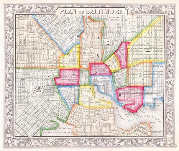
| Keywords: 1860 Mitchell Map of Baltimore - Geographicus - Baltimore-m-60.jpg This scarce hand colored map is a lithographic engraving of Baltimore Maryland dating to 1860 by the legendary American Mapmaker S A Mitchell the younger This is perhaps the most attractive of all the Mitchell Baltimore maps as only this and the 1861 edition offer beautiful vivid hand coloring within each of the city districts Later editions tend to use only reds This map was originally part of the 1860 edition of Mitchell ™s New General Atlas Dated and copyrighted 1860 1860 dated Size in 11 10 object history credit line accession number Baltimore-m-60 Geographicus-source PD-old-100 Maps by Samuel Augustus Mitchell Old maps of Baltimore 1860 maps | ||||