MAKE A MEME
View Large Image

| View Original: | 1858_Dispatch_Atlas_Map_of_Egypt,_Nubia,_Abyssinia_and_the_Red_Sea_-_Geographicus_-_EgyptNubia-dispatch-1858.jpg (4207x6000) | |||
| Download: | Original | Medium | Small | Thumb |
| Courtesy of: | commons.wikimedia.org | More Like This | ||
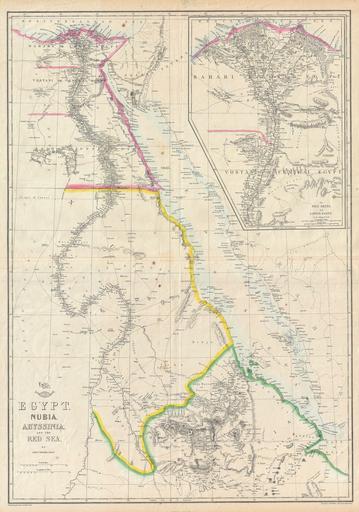
| Keywords: 1858 Dispatch Atlas Map of Egypt, Nubia, Abyssinia and the Red Sea - Geographicus - EgyptNubia-dispatch-1858.jpg This is a hand colored map of Egypt Nubia and Abyssinia dating to 1858 by London cartographer Edward Weller Depicts northeastern Africa from what is today central Ethiopia northward along the Nile to Egypt and the Delta Shows the Red Sea in full along with parts of Saudi Arabia An inset in the upper right quadrant details the Nile Delta and Egypt ôs Central Valley Notes Mount Sinai as well as the location of many ancient Egyptian ruins Originally part of the Weekly Dispatch Atlas whose September 19th 1958 stamp still appears on the top left of the map 1858 dated Size in 17 24 5 object history credit line accession number EgyptNubia-dispatch-1858 <i>Cassell ôs Weekly Dispatch Atlas</i> c 1858 Geographicus-source PD-art Maps of the Red Sea Old maps of the Nile 1858 maps 1858 in Egypt Maps of river deltas Egyptian Halayeb Triangle in 1858 Harbours in Egypt | ||||