MAKE A MEME
View Large Image
| View Original: | 1857_Colton_Map_of_Paris,_France_-_Geographicus_-_Paris-cbl-1855.jpg (3500x2855) | |||
| Download: | Original | Medium | Small | Thumb |
| Courtesy of: | commons.wikimedia.org | More Like This | ||
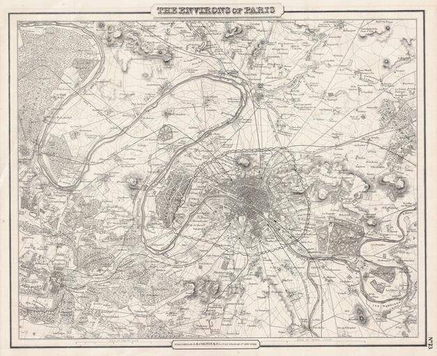
| Keywords: 1857 Colton Map of Paris, France - Geographicus - Paris-cbl-1855.jpg This rare hand colored map of Paris and Environs is a copper plate engraving dating to 1857 Produced by the respected mid 19th century American Mapmaker J H Colton Map covers the Seine valley in a roughly 30 mile radius of Paris Versailles appears in the extreme southwest and Vitry in the extreme northeast The whole is beautifully detailed down to individual buildings Earlier editions feature a vine border however this embellishment was dropped for the 1857 issue Prepared out of Colton's 172 William St New York office for inclusion as plate no 73 in the 1857 issue of Colton's General Atlas Dated and copyrighted Entered according to Act of Congress in the Year 1855 by J H Colton Co in the Clerk's Office of the District Court of the United States for the Southern District of New York 1855 - 57 dated Size in 14 75 12 object history credit line accession number Paris-cbl-1855 Geographicus-source PD-old-100 Maps by Joseph Hutchins Colton Old maps of Île-de-France Maps of Paris in the 19th century 19th-century maps of Paris 1855 maps 1855 in Paris | ||||