MAKE A MEME
View Large Image
| View Original: | 1855_Spruneri_Map_of_Arabia,_Egypt_and_Ethiopia_or_Abyssinia_-_Geographicus_-_Arabia-spruneri-1855.jpg (2500x1999) | |||
| Download: | Original | Medium | Small | Thumb |
| Courtesy of: | commons.wikimedia.org | More Like This | ||
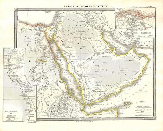
| Keywords: 1855 Spruneri Map of Arabia, Egypt and Ethiopia or Abyssinia - Geographicus - Arabia-spruneri-1855.jpg This fine hand colored map is a steel plate lithograph depicting Arabia Arabian Peninsula Egypt and Ethiopia or Abyssinia in ancient times Includes the ancient almost mythical kingdom of Axum in northern Ethiopia “ birthplace of the Queen of Sheba and supposed resting place of the Arc of the Covenant to this very day It was published in 1855 by the legendary German cartographer Justus Perthes Issued as part of the Spruneri Atlas Antiquarie 1855 Size in 16 13 object history credit line accession number Arabia-spruneri-1855 Geographicus-source PD-old-100 Maps by Justus Perthes Old maps of Africa Old maps of the Middle East 1855 maps | ||||