MAKE A MEME
View Large Image
| View Original: | 1855_Colton's_Map_of_Southern_Italy,_Sicily,_Sardinia_and_Malta_-_Geographicus_-_ItalySouth-colton-1855.jpg (3500x2871) | |||
| Download: | Original | Medium | Small | Thumb |
| Courtesy of: | commons.wikimedia.org | More Like This | ||
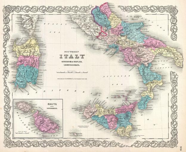
| Keywords: 1855 Colton's Map of Southern Italy, Sicily, Sardinia and Malta - Geographicus - ItalySouth-colton-1855.jpg A beautiful 1855 first edition example of Colton's map of Southern Italy Covers the southern part of the Italian peninsula from Abruzzo to Melito inclusive of the Kingdom of Naples Also includes the islands of Sicily and Sardinia An inset map in the lower left quadrant details Malta and Gozo Throughout Colton identifies various cities towns forts rivers and an assortment of additional topographical details Surrounded by Colton's typical spiral motif border Dated and copyrighted to J H Colton 1855 Published from Colton's 172 William Street Office in New York City Issued as page no 19 in volume 2 of the first edition of George Washington Colton's 1855 Atlas of the World 1855 dated Size in 16 13 5 object history credit line accession number ItalySouth-colton-1855 Colton G W <i>Colton's Atlas of the World Illustrating Physical and Political Geography</i> Vol 2 New York 1855 First Edition Geographicus-source PD-old-100 Maps by Joseph Hutchins Colton Maps of the Kingdom of the Two Sicilies 1855 Old maps of Abruzzo Old maps of Molise Old maps of Campania Old maps of Calabria Old maps of Basilicata Old maps of Apulia Old maps of Sicily Old maps of Sardinia Old maps of Malta Maps of Southern Italy | ||||