MAKE A MEME
View Large Image
| View Original: | 1855_Colton_Map_of_Washington_D.C._-_Geographicus_-_WashingtonDC-colton-1855.jpg (4000x3318) | |||
| Download: | Original | Medium | Small | Thumb |
| Courtesy of: | commons.wikimedia.org | More Like This | ||
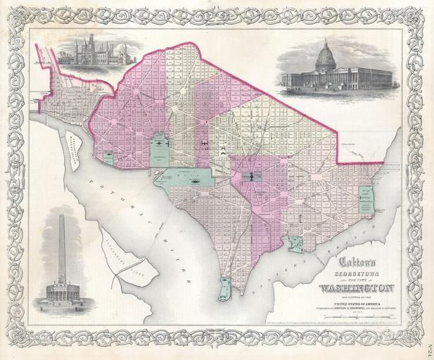
| Keywords: 1855 Colton Map of Washington D.C. - Geographicus - WashingtonDC-colton-1855.jpg A very attractive example of Colton ™s 1855 Map of Washington D C and Georgetown Covers the city in incredible detain from Georgetown Georgetown University then college shown in the upper left quadrant to Alexander ™s Island in the south and as far east as Magazine Warf Individual buildings such as the Smithsonian the White House the Capitol the Arsenal Penitentiary Naval Yard Poor House Asylum and Post office are all indicated Features three inset engravings The Smithsonian Institution the Capitol and a presumptive Washington Monument Prepared by J H Colton and Company for issue as plate no 24 in Colton ™s General Atlas Title bears the Johnson and Browning imprint suggesting that this is an 1860 or 1861 issue of the map despite the 1855 copyright 1855 dated Size in 16 13 object history credit line accession number WashingtonDC-colton-1855 Geographicus-source PD-old-100 Maps by Joseph Hutchins Colton Old maps of Washington D C 1855 maps | ||||