MAKE A MEME
View Large Image
| View Original: | 1855_Colton_Map_of_Virginia_-_Geographicus_-_Virginia-colton-1855.jpg (4000x3289) | |||
| Download: | Original | Medium | Small | Thumb |
| Courtesy of: | commons.wikimedia.org | More Like This | ||
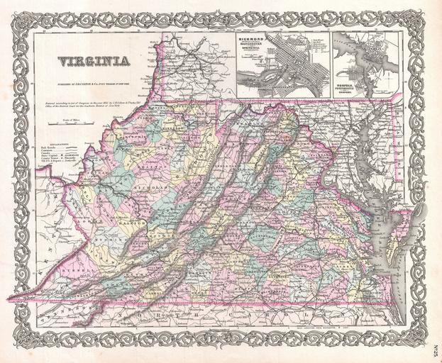
| Keywords: 1855 Colton Map of Virginia - Geographicus - Virginia-colton-1855.jpg A beautiful 1855 first edition example of Colton's map of Virginia Covers the entire state as well most of adjacent Maryland and parts of North Carolina Kentucky and Tennessee Predates split with West Virginia by seven years Map is hand colored in pink green yellow and blue pastels to identify counties Identifies towns cities railroads roads and some topographical features Features maps of Richmond with Manchester and Spring Hill and Norfolk with Portsmouth and Gosport Names the Cumberland Gap Chesapeake Bay Alleghany and Shenandoah Mountains and the Dismal Swamp Surrounded by Colton's typical spiral motif border Dated and copyrighted to J H Colton 1855 Published from Colton's 172 William Street Office in New York City Issued as page no 25 in volume 1 of the first edition of George Washington Colton's 1855 Atlas of the World 1855 dated Size in 16 13 object history credit line accession number Virginia-colton-1855 Colton G W <i>Colton's Atlas of the World Illustrating Physical and Political Geography</i> Vol 1 New York 1855 First Edition Geographicus-source PD-old-100 Maps by Joseph Hutchins Colton Old maps of Virginia 1855 maps | ||||