MAKE A MEME
View Large Image

| View Original: | 1853_U.S.C.S._Map_of_San_Diego_Bay_^_Los_Coronados_-_Geographicus_-_SanDiego-uscs-1853.jpg (4003x3821) | |||
| Download: | Original | Medium | Small | Thumb |
| Courtesy of: | commons.wikimedia.org | More Like This | ||
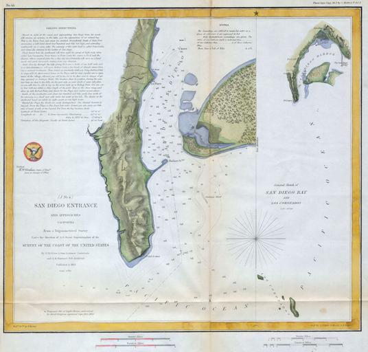
| Keywords: 1853 U.S.C.S. Map of San Diego Bay ^ Los Coronados - Geographicus - SanDiego-uscs-1853.jpg A fine early U S Coast Survey chart or map of San Diego Bay Essentially two maps in one chart separated by a compass rose The first map shows San Diego bay and Harbor just south of the city of San Diego The second right hand map depicts a more general view of the area extending as far south as the Coronados Island Group Beautifully hand colored This map was created under the direction of A D Bache Superintendent of the Survey of the Coast of the United States and one of the most influential American cartographers of the 19th century 1853 Size in 13 13 object history credit line accession number SanDiego-uscs-1853 Geographicus-source PD-art United States Coast Survey maps 1853 maps Old maps of California San Diego Bay | ||||