MAKE A MEME
View Large Image
| View Original: | 1852_U.S._Coast_Survey_Map_of_Cedar_Key,_Florida_-_Geographicus_-_CedarKey-uscs-1852.jpg (2500x2189) | |||
| Download: | Original | Medium | Small | Thumb |
| Courtesy of: | commons.wikimedia.org | More Like This | ||
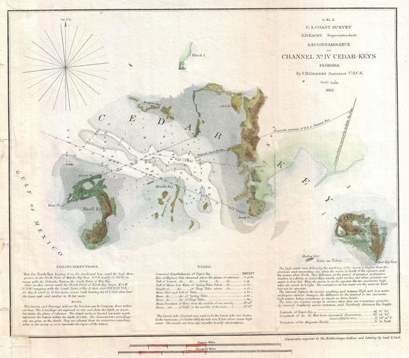
| Keywords: 1852 U.S. Coast Survey Map of Cedar Key, Florida - Geographicus - CedarKey-uscs-1852.jpg This is an important 1852 U S Coast Survey mapping of Cedar Key Following the Seminole Wars the government pushed for settlement of Florida and increased harvesting of its many natural resources Cedar Key situated on the Florida coast between Tampa and Apalachicola was identified as a central to this plan for its potential as a shipping port The U S Coast survey sent its top Gulf of Mexico expert F H Gerdes to survey the Key in anticipation of constructing a Steam Pier and Railroad Following the Civil War Cedar Key did in fact develop considerable a shipping trade as well as a number of mills and other factories but most of these were destroyed in a series of violent hurricanes in the late 19th century Published in 1852 under the supervision of A D Bache Superintendent of the U S Coast Survey 1852 dated Size in 11 10 object history credit line accession number CedarKey-uscs-1852 <i>Report of the Superintendant of the United States Coast Survey </i> Washington 1852 edition Geographicus-source PD-art United States Coast Survey maps Old maps of Florida Cedar Key Florida 1852 maps 1852 U S Coast survey | ||||