MAKE A MEME
View Large Image
| View Original: | 1852_Bocage_Map_of_Australia_and_Polynesia_-_Geographicus_-_Oceanie-bocage-1852.jpg (3000x2210) | |||
| Download: | Original | Medium | Small | Thumb |
| Courtesy of: | commons.wikimedia.org | More Like This | ||
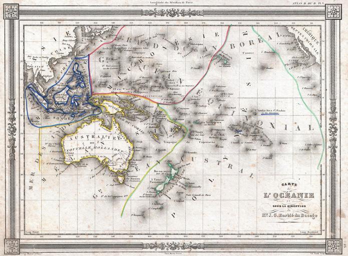
| Keywords: 1852 Bocage Map of Australia and Polynesia - Geographicus - Oceanie-bocage-1852.jpg An uncommon and extremely attractive 1852 map of Oceania by J G Barbie du Bocage Includes Australia New Zealand Polynesia Micronesia Melanesia and Malaysia Australia is described as pays inconnu and alternately labeled New Holland Hawaii shown as the Sandwich Islands Features a beautiful frame style border Prepared by J G Barbie du Bocage for publication as plate no 25 in Maison Basset ™s 1852 edition of the Atlas Illustre 1852 undated Size in 12 5 9 object history credit line accession number Oceanie-bocage-1852 Maison Basset <i>Atlas Illustre</i> 1852 issue Geographicus-source PD-art Maps by Jean Guillaume BarbiĂ© du Bocage Old maps showing history of Oceania Old maps of the Pacific Ocean 1852 maps Maps in French Old maps of Southeast Asia 1852 in New Zealand | ||||