MAKE A MEME
View Large Image
| View Original: | 1850_Mitchell_Map_of_Spain_and_Portugal_-_Geographicus_-_SpainPortugal-mitchell-1850.jpg (3000x2423) | |||
| Download: | Original | Medium | Small | Thumb |
| Courtesy of: | commons.wikimedia.org | More Like This | ||
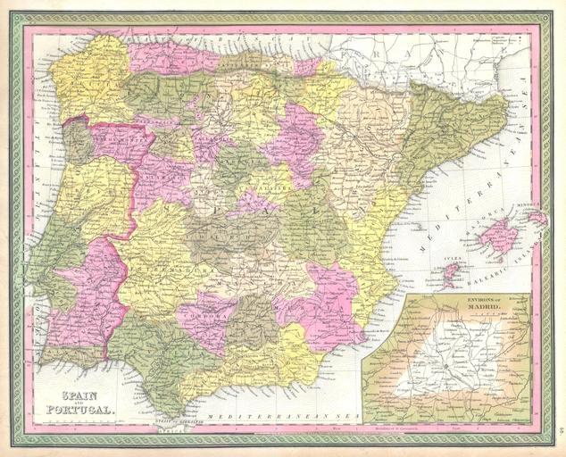
| Keywords: 1850 Mitchell Map of Spain and Portugal - Geographicus - SpainPortugal-mitchell-1850.jpg This hand colored map is a copper plate engraving dating to 1850 by the legendary American mapmaker S A Mitchell the elder It represents Spain and Portugal Includes the Balearic Islands of Ibiza Majorca and Minorca Lower right quadrant features inset map of environs of Madrid Prepared by H N Burroughs for the 1850 edition of Mitchell's New General Atlas Dated and copyrighted Entered according to Act of Congress in the year 1846 by H N Burroughs in the Clerk's office of the District Court of the Eastern District of Pennsylvania 1850 Size in 16 13 object history credit line accession number SpainPortugal-mitchell-1850 Geographicus-source PD-old-100 Maps by Samuel Augustus Mitchell Old maps of the Iberian Peninsula 1850 maps Maps of the Community of Madrid Maps in English | ||||