MAKE A MEME
View Large Image
| View Original: | 1850_Mitchell_Map_of_Europe_-_Geographicus_-_Europe-mitchell-1850.jpg (3500x2788) | |||
| Download: | Original | Medium | Small | Thumb |
| Courtesy of: | commons.wikimedia.org | More Like This | ||
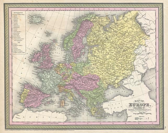
| Keywords: 1850 Mitchell Map of Europe - Geographicus - Europe-mitchell-1850.jpg An attractive example of S A Mitchell Sr ™s 1850 map of Europe Depicts the entire continent color coded according to individual countries Surrounded by the green border common to Mitchell maps from the 1850s Prepared by S A Mitchell for issued as plate no 45 in the 1850 edition of his New Universal Atlas Dated and copyrighted Entered according to act of Congress in the year 1850 by Thomas Cowperthwait Co in the Clerks office of the District court of the Eastern District of Pennsylvania 1850 dated Size in 15 5 12 5 object history credit line accession number Europe-mitchell-1850 Mitchell Sr S A <i>A New Universal Atlas Containing Maps of the various Empires Kingdoms States and Republics Of The World </i> 1850 issue Geographicus-source PD-old-100 Maps by Samuel Augustus Mitchell Old maps of Europe 1850 1850 maps English language maps of Europe | ||||