MAKE A MEME
View Large Image
| View Original: | 1850_Mitchell_and_Cowperthwait_Map_of_Ireland_-_Geographicus_-_Ireland-m-1850.jpg (2416x3000) | |||
| Download: | Original | Medium | Small | Thumb |
| Courtesy of: | commons.wikimedia.org | More Like This | ||
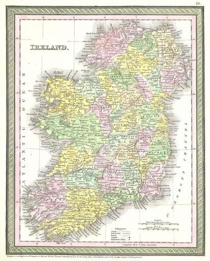
| Keywords: 1850 Mitchell and Cowperthwait Map of Ireland - Geographicus - Ireland-m-1850.jpg This beautiful hand colored map is a lithographic engraving of Ireland dating to 1850 by the legendary American map publisher S A Mitchell the elder Dated and copyrighted Entered according to act of Congress in the year of 1850 by Thomas Copwerthwait and Co in the clerks Office of the District court of the Eastern District of Pennsylvania 1850 Size in 12 5 10 object history credit line accession number Ireland-m-1850 Geographicus-source PD-old-100 Maps by Samuel Augustus Mitchell Old maps of Ireland 1850 maps English language maps of Europe | ||||