MAKE A MEME
View Large Image
| View Original: | 1850_Hand_Drawn_Japaese_Map_of_Hokkaido,_Japan_-_Geographicus_-_Hokkaido-japan-1850.jpg (5000x2970) | |||
| Download: | Original | Medium | Small | Thumb |
| Courtesy of: | commons.wikimedia.org | More Like This | ||
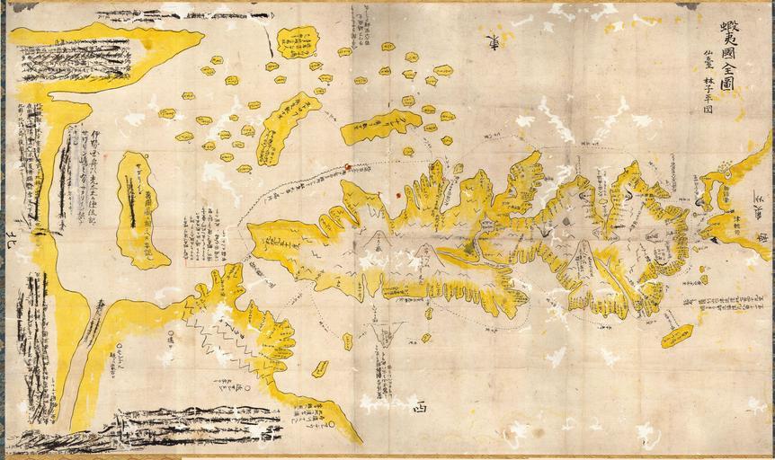
| Keywords: 1850 Hand Drawn Japaese Map of Hokkaido, Japan - Geographicus - Hokkaido-japan-1850.jpg This fascinating hand colored and hand drawn map depicts the Japanese Island of Hokkaido This very unusual map differs radically from other maps of this period as it is both wildly inaccurate and hand drawn It was most likely copied from an earlier text The map has been in a Japanese collection where it was professionally rebacked and mounted on a patterned silk scroll in typical Japanese style There is some interested text that has been crossed out but I have not yet completed its translation An altogether fascinating map ~ 1850 Size in 22 36 object history credit line accession number Hokkaido-japan-1850 Geographicus-source PD-art Manuscript maps Maps in Japanese 1850 maps Old maps of Hokkaido | ||||