MAKE A MEME
View Large Image
| View Original: | 1850_Cowperthwait_-_Mitchell_Map_of_Massachusetts_and_Rhode_Island_-_Geographicus_-_MA-m-50.jpg (3000x2286) | |||
| Download: | Original | Medium | Small | Thumb |
| Courtesy of: | commons.wikimedia.org | More Like This | ||
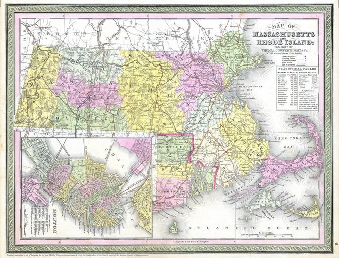
| Keywords: 1850 Cowperthwait - Mitchell Map of Massachusetts and Rhode Island - Geographicus - MA-m-50.jpg This hand colored map is a copper plate engraving dating to 1850 by the legendary American Mapmaker S A Mitchell the elder It represents Massachusetts and Rhode Island Contains a beautiful inset map of downtown Boston This map also contains notes on population in the two states This historically important map is extremely rare as it existed only in the 1850 edition of the Mitchell ™s Universal Atlas 1850 Size in 14 12 object history credit line accession number MA-m-50 Geographicus-source PD-old-100 Maps by Samuel Augustus Mitchell Old maps of Massachusetts Old maps of Rhode Island 1850 maps Old maps of Boston Maps in English Rail transport maps of Massachusetts Rail transport maps of Rhode Island | ||||