MAKE A MEME
View Large Image
| View Original: | 1845_Chambers_Map_of_Palestine_-_Israel_-_Holy_Land_-_Geographicus_-_Palestine-chambers-1845.jpg (2027x2500) | |||
| Download: | Original | Medium | Small | Thumb |
| Courtesy of: | commons.wikimedia.org | More Like This | ||
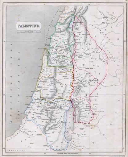
| Keywords: 1845 Chambers Map of Palestine - Israel - Holy Land - Geographicus - Palestine-chambers-1845.jpg This is an 1845 Map of Palestine or Israel or the Holy Land Depicts from the Dead Sea in the south to Tyre and Sidon on the north Full of wonderful details referring to Biblical narrative Published by William and Robert Chambers 1845 Size in 11 9 object history credit line accession number Palestine-chambers-1845 Geographicus-source PD-art 1845 maps Maps of Ottoman Levant 1845 Old maps of Israel Old maps of Jordan Old maps of Palestine Old maps of the Holy Land Maps of the Ottoman Empire in the 19th-century 1845 Ottoman Palestine in the 19th century 1845 Maps in English J Gellatly | ||||