MAKE A MEME
View Large Image
| View Original: | 1843_Malte-Brun_Map_of_Prussia,_Germany_-_Geographicus_-_Prussia-malteburn-1843.jpg (3000x2084) | |||
| Download: | Original | Medium | Small | Thumb |
| Courtesy of: | commons.wikimedia.org | More Like This | ||
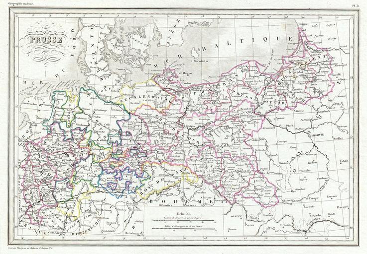
| Keywords: 1843 Malte-Brun Map of Prussia, Germany - Geographicus - Prussia-malteburn-1843.jpg This is an attractive 1843 map of Prussia by the French cartographer Victor Adolphe Malte-Brun Covers what is today northern Germany from Rhineland eastward to East Prussia Extends southwards as far as Prague and Wurtemberg Offers excellent detail and color coding by region Published as plate no 1843 undated Size in 13 9 object history credit line accession number de Toutes Les Parties du Monte sur un Plan Nouveau D' Apres les Grands Divisions Naturelles du Globe </i> 1843 edition Geographicus-source PD-art 1843 maps Victor Adolphe Malte-Brun Old maps of Prussia | ||||