MAKE A MEME
View Large Image
| View Original: | 1840_S.D.U.K._Map_or_City_Plan_of_Toulon,_France_-_Geographicus_-_Tulon-SDUK-1840.jpg (2750x2200) | |||
| Download: | Original | Medium | Small | Thumb |
| Courtesy of: | commons.wikimedia.org | More Like This | ||
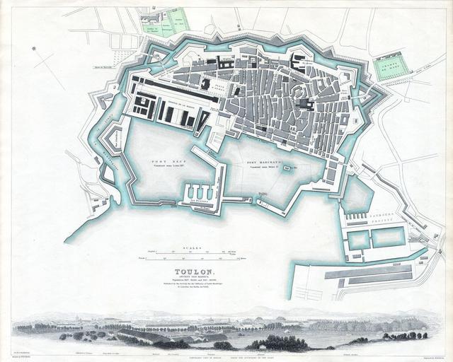
| Keywords: 1840 S.D.U.K. Map or City Plan of Toulon, France - Geographicus - Tulon-SDUK-1840.jpg This map is a steel plate engraving dating to 1840 and published by the S D U K or The Society for the Diffusion of Useful Knowledge It represents the southern French city of Toulon on the French Riviera between Marseilles San Tropez 1840 Size in 15 13 object history credit line accession number Tulon-SDUK-1840 <i>Maps of the Society for the Diffusion of Useful Knowledge </i> Vol1 1844 Geographicus-source PD-art Old maps of Toulon 1840 maps Toulon Society for the Diffusion of Useful Knowledge Great Britain | ||||