MAKE A MEME
View Large Image
| View Original: | 1837_S.D.U.K._City_Map_or_Plan_of_Frankfort,_Germany_-_Geographicus_-_Frankfurt-SDUK-1837.jpg (2750x2194) | |||
| Download: | Original | Medium | Small | Thumb |
| Courtesy of: | commons.wikimedia.org | More Like This | ||
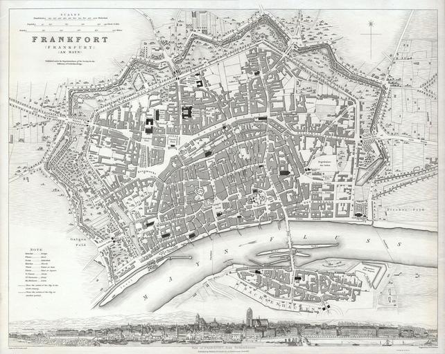
| Keywords: 1837 S.D.U.K. City Map or Plan of Frankfort, Germany - Geographicus - Frankfurt-SDUK-1837.jpg This map is a steel plate engraving dating to 1837 and published by the S D U K or The Society for the Diffusion of Useful Knowledge It represents the world famous German city of Frankfort or Frankfurt All important buildings bridges and parks are shown Across the bottom of the map there is a stunning panoramic of Frankfort from Sachsenhausen 1837 Size in 15 13 object history credit line accession number Frankfurt-SDUK-1837 <i>Maps of the Society for the Diffusion of Useful Knowledge </i> Vol1 1844 Geographicus-source PD-art Maps of Frankfurt am Main showing 19th-century history 1837 maps Society for the Diffusion of Useful Knowledge Great Britain Frankfurt am Main in art | ||||