MAKE A MEME
View Large Image
| View Original: | 1837_Malte-Brun_Map_of_Italy_in_Ancient_Roman_Times_-_Geographicus_-_ItalyAncient-mb-1837.jpg (2500x1953) | |||
| Download: | Original | Medium | Small | Thumb |
| Courtesy of: | commons.wikimedia.org | More Like This | ||
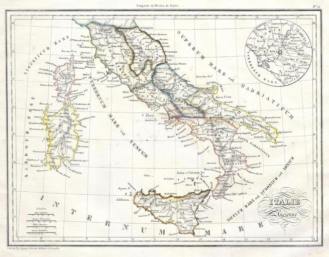
| Keywords: 1837 Malte-Brun Map of Italy in Ancient Roman Times - Geographicus - ItalyAncient-mb-1837.jpg This is a beautiful 1837 hand colored lithograph map of Italy in Ancient Roman times Includes an inset plan of the vicinity of Rome All text is in French Dated 1835 1837 dated Size in 11 5 9 object history credit line accession number de Toutes Les Parties Du Monde sur un Plan Nouveau D'Apres Les Grands Dividisons Naturelles du Globe</i> 1843 Geographicus-source PD-art 1837 maps Old Maps of the Italian Peninsula in History Old maps of the Roman Empire Maps in Latin Victor Adolphe Malte-Brun | ||||