MAKE A MEME
View Large Image
| View Original: | 1836_map_of_Warsaw_5.jpg (6426x6023) | |||
| Download: | Original | Medium | Small | Thumb |
| Courtesy of: | commons.wikimedia.org | More Like This | ||
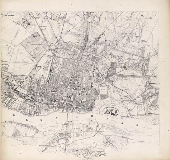
| Keywords: 1836 map of Warsaw 5.jpg en The central part of Warsaw on a 1836 map published only in 1860 Scale 1 16800 pl Arkusz 5 mapy obejmuj─ģcy Warszaw─Ö stan na 1836 rok map─Ö opublikowano w 1860 Skala 1 16800 1860 5th part of a Russian ąÜąÉąĀąóąÉ ą×ąÜąĀąĢąĪąóą ą×ąĪąóąĢąÖ ąÆąÉąĀą©ąÉąÆą½ Map of the Environs of Warsaw prepared in 1836 published in 1860 Scanned by mapywig org http //polski mapywig org/viewpage php page_id 36 The Russian map is in fact a Russian translation of the 1829 anonymous French language Plan des environs de Varsovie Creator Unknown Custom license marker 2013 08 25 PD-Russia Uploaded with UploadWizard Historical maps of Warsaw | ||||