MAKE A MEME
View Large Image
| View Original: | 1834_Keller_Pocket_Map_of_Switzerland_-_Geographicus_-_Switzerland-keller-1834.jpg (5000x4239) | |||
| Download: | Original | Medium | Small | Thumb |
| Courtesy of: | commons.wikimedia.org | More Like This | ||
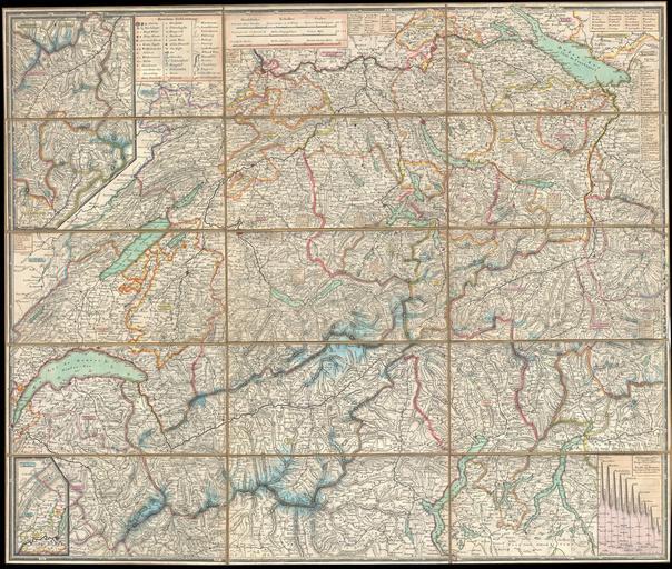
| Keywords: 1834 Keller Pocket Map of Switzerland - Geographicus - Switzerland-keller-1834.jpg This is an extremely detailed and attractive 1834 folding pocket map of Switzerland drawn by the Zurich cartographer and lithographer Heinrich Keller Covers the mountainous country from Lake Geneva to Lake Constance Details numerous river ways likes cities roadways forts castles and monasteries A stunning and rare example of 19th century Swiss cartography 1834 dated Size in 25 75 21 5 object history credit line accession number Switzerland-keller-1834 Geographicus-source PD-old-100 Old maps of Switzerland 1834 maps Heinrich Keller Maps in German | ||||