MAKE A MEME
View Large Image
| View Original: | 1832_Delamarche_Map_of_Greece_and_the_Balkans_-_Geographicus_-_Greece-d-32.jpg (2700x2390) | |||
| Download: | Original | Medium | Small | Thumb |
| Courtesy of: | commons.wikimedia.org | More Like This | ||
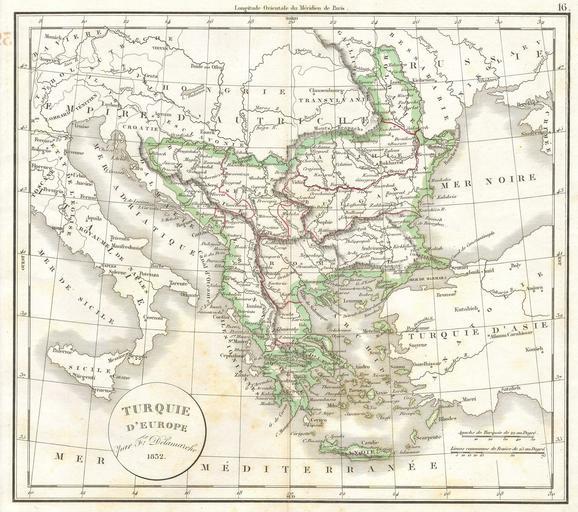
| Keywords: 1832 Delamarche Map of Greece and the Balkans - Geographicus - Greece-d-32.jpg This hand colored map is a copper plate engraving dating to 1832 by the well known French mapmaker Delamarche It is a representation of Greece and the Balkans Formally titled Turquie d'Europe as this was then part of the great Ottoman Empire 1832 Size in 13 12 object history credit line accession number Greece-d-32 Geographicus-source PD-art 19th-century maps of the Balkans Old maps of Turkey Charles François Delamarche 1832 maps Maps in French | ||||