MAKE A MEME
View Large Image
| View Original: | 1826_-_Bulla_&_Fontana_-_Comparative_Chart_of_the_World's_Principal_Mountains,_Rivers_and_Waterfalls.jpg (9894x6899) | |||
| Download: | Original | Medium | Small | Thumb |
| Courtesy of: | commons.wikimedia.org | More Like This | ||
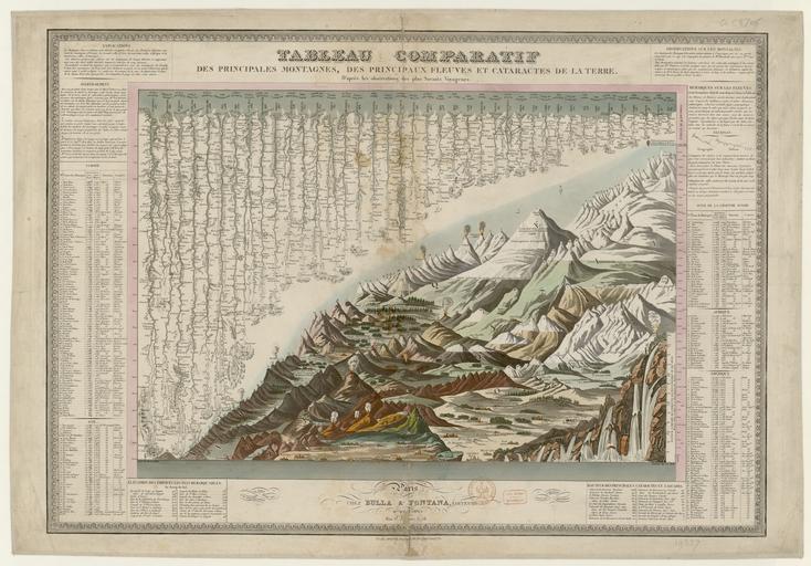
| Keywords: 1826 - Bulla & Fontana - Comparative Chart of the World's Principal Mountains, Rivers and Waterfalls.jpg Comparative Chart of the World's Principal Mountains Rivers and Waterfalls 1826 size cm 52 74 Institution Bibliothèque nationale de France Département Cartes et plans accession number GE C-8706 http //gallica bnf fr/ark /12148/btv1b53093542g Gallica PD-old-70-1923 Uploaded with UploadWizard Geographic comparison diagrams | ||||