MAKE A MEME
View Large Image
| View Original: | 1821_Carey_Map_of_India_-_Geographicus_-_India-carey-1821.jpg (5000x4130) | |||
| Download: | Original | Medium | Small | Thumb |
| Courtesy of: | commons.wikimedia.org | More Like This | ||
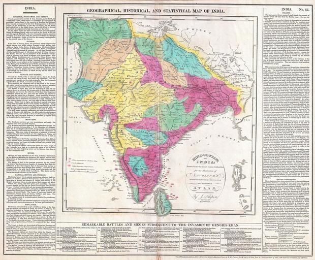
| Keywords: 1821 Carey Map of India - Geographicus - India-carey-1821.jpg This is an attractive 1821 map of India issued by Matthew Carey Covers the subcontinent from Tibet Kashmir south to Sri Lanka or Ceylon Color coded according to territory with British possessions or dependencies in red Shows the locations and dates of no less than twenty-five battles from 1300 to 1804 Surrounded by text discussing the geography climate history and peoples of India Drawn by J Aspin Published by Matthew Carey Son as plate no 65 in the 1821 third Philadelphia edition of Lavoisne ™s Genealogical Historical Chronological and Geographical Atlas 1821 dated Size in 21 17 object history credit line accession number India-carey-1821 Lavoisine C V <i>Lavoisne's Genealogical Historical Chronological And Geographical Atlas </i> 1821 Philadelphia Edition Geographicus-source PD-Art-100 Old maps of South Asia 1821 maps Maps in English Jehoshaphat Aspin | ||||