MAKE A MEME
View Large Image
| View Original: | 1818_Pinkerton_Map_of_Northern_Africa_and_the_Mediterranean_-_Geographicus_-_NorthernAfrica-pinkerton-1818.jpg (5000x3649) | |||
| Download: | Original | Medium | Small | Thumb |
| Courtesy of: | commons.wikimedia.org | More Like This | ||
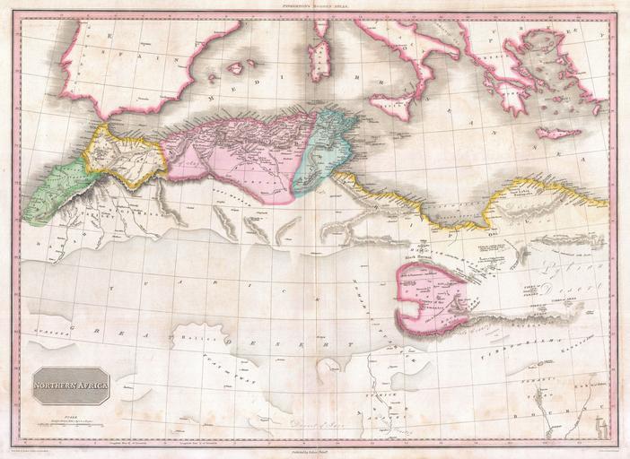
| Keywords: 1818 Pinkerton Map of Northern Africa and the Mediterranean - Geographicus - NorthernAfrica-pinkerton-1818.jpg This fascinating hand colored 1818 map by Edinburgh cartographer John Pinkerton depicts northern Africa Covers from Morocco to Siwa Siwah Oasis in the Libyan Desert Focuses Morocco and the Mediterranean regions of Fez Algeria Tunisia and Tripoli Also shows the Kingdom of Fezzan Though mostly desert Fezzan has numerous oaises and supported a relatively large population This desert kingdom was a critical stopping point for trade caravans crossing the Sahara since antiquity Drawn by L Herbert and engraved by Samuel Neele under the direction of John Pinkerton This map comes from the scarce American edition of Pinkerton ™s Modern Atlas published by Thomas Dobson Co of Philadelphia in 1818 1818 undated Size in 28 20 5 object history credit line accession number NorthernAfrica-pinkerton-1818 Pinkerton J <i>A Modern Atlas from the Lates and Best Authorities Exhibiting the Various Divisions of the World with its chief Empires Kingdoms and States; in Sixty Maps carefully reduced from the Larges and Most Authentic Sources </i> 1818 Philadelphia Thomas Dobson Edition Geographicus-source PD-old-100 Maps by John Pinkerton Old maps of Africa 1818 maps | ||||