MAKE A MEME
View Large Image
| View Original: | 1782_d'Anville_Map_of_the_Eastern_Roman_Empire_-_Geographicus_-_RomanEmpireEast-anville-1782.jpg (4831x6000) | |||
| Download: | Original | Medium | Small | Thumb |
| Courtesy of: | commons.wikimedia.org | More Like This | ||
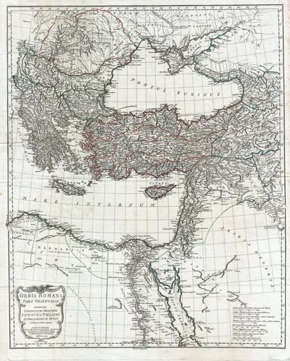
| Keywords: 1782 d'Anville Map of the Eastern Roman Empire - Geographicus - RomanEmpireEast-anville-1782.jpg This is the stunning eastern sheet from Jean Baptiste Bourguignon D ™Anville ™s two map set depicting the Roman Empire Depicts the eastern portion of the Mediterranean inclusive of Greece and extends inland as far as modern day Armenia Contains the whole of the Black Sea Pontus Euxinus and extends south well into the Arabian Desert Egypt and Nubia Includes the modern day nations of Greece Turkey Macedonia Ukraine Armenia Israel / Palestine Egypt Jordan Syria Lebanon et al Uses archaic place names throughout Decorative title cartouche at the bottom left quadrant Engraved by Guillaume Delahaye for publication in the 1782 edition of Anville ™s Atlas General 1782 Size in 26 5 21 5 object history credit line accession number RomanEmpireEast-anville-1782 D'Anville J B B <i>Atlas Generale</i> 1782 edition Geographicus-source PD-art-100 Old maps of the Black Sea Old maps of the Middle East Old maps of Armenia Old maps of Turkey 1782 maps 18th-century maps of Georgia Old maps of Greece Old maps of Egypt Old maps of the Byzantine Empire | ||||