MAKE A MEME
View Large Image

| View Original: | 1760_Bellin_Map_of_the_Moluccas_(_Maluku_,_Moluques_)_-_Geographicus_-_Moluques-bellin-1760.jpg (1966x2735) | |||
| Download: | Original | Medium | Small | Thumb |
| Courtesy of: | commons.wikimedia.org | More Like This | ||
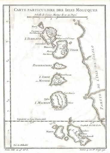
| Keywords: 1760 Bellin Map of the Moluccas ( Maluku , Moluques ) - Geographicus - Moluques-bellin-1760.jpg This beautiful little map of the Moluques also known as the Moluccas Moluccan Islands or simply Maluku was produced by the French Cartographer Jacques-Nicolas Bellin in 1760 Depicts the islands of Herij Ternate Tidor Pottebackers Timor Machian and Bachian The Moluccan islands were once part of the Dutch East Indies Today the Moluccas are part of Indonesia 1760 Size in 9 6 5 object history credit line accession number Moluques-bellin-1760 Geographicus-source PD-old-100 Maps of Maluku 1760 maps Old maps of Indonesia Maps by Jacques-Nicolas Bellin | ||||