MAKE A MEME
View Large Image
| View Original: | 1757_Homann_Heirs_Map_of_Saxony,_Germany,_and_the_Czech_Republic_-_Geographicus_-_Saxoniae-hmhr-1757.jpg (5000x4299) | |||
| Download: | Original | Medium | Small | Thumb |
| Courtesy of: | commons.wikimedia.org | More Like This | ||
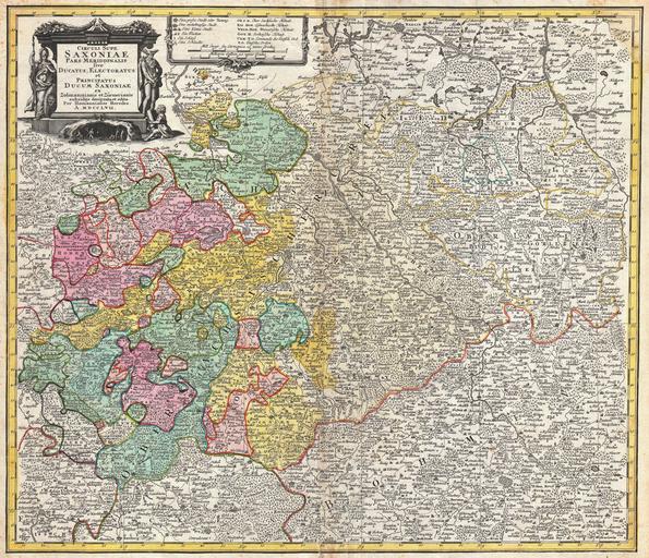
| Keywords: 1757 Homann Heirs Map of Saxony, Germany, and the Czech Republic - Geographicus - Saxoniae-hmhr-1757.jpg A fine example of the Homann Heirs map of Saxony Germany Covers from Berlin in the north to Prague in the southeast and Efurt in the west The map is filled with information including fortified cities villages roads bridges forests battlefields castles and topography Title cartouche in the upper left quadrant features a wonderful mining vignette the Greek god Hermes and a warrior figure with a shield featuring the head of Medusa Prepared in Nuremberg by the engravers Adam Friedrich ZĂĽrner and Zolman for issue in Homann Heirs ™ Maior Atlas Scholasticus 1757 undated Size in 22 19 object history credit line accession number Saxoniae-hmhr-1757 <i>Major Atlas Scholasticus Ex Triginta sex Generalibus et Specialibus Mappis Homannianis </i> c 1760 Geographicus-source PD-Art-100 Maps by Homannsche Erben Old maps of Saxony Maps by Adam Friedrich ZĂĽrner Maps by Friedrich Zollmann 1757 maps Maps in Latin | ||||