MAKE A MEME
View Large Image
| View Original: | 1753_Van_Keulen_Maldives_Map.jpg (5921x6787) | |||
| Download: | Original | Medium | Small | Thumb |
| Courtesy of: | commons.wikimedia.org | More Like This | ||
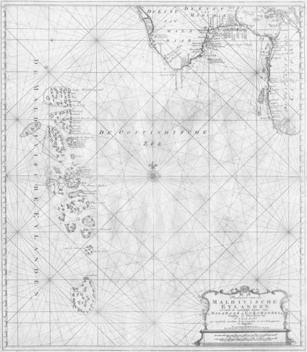
| Keywords: 1753 Van Keulen Maldives Map.jpg Extremely rare set of map that was published only in the secret atlas of the Dutch East India Company for internal use No doubt at that time the very best and most detailed set of charts of the region www helmink com 1753 van Keulen PD-old-100 Old maps of the Indian Ocean Maps in Dutch Maldivische Eylanden Maps of the Dutch East India Company - Maldives 1753 maps Maldivische Eylanden | ||||