MAKE A MEME
View Large Image
| View Original: | 1748_Vaugondy_Map_of_Ireland_-_Geographicus_-_Ireland-vaugondy-1749.jpg (2128x2193) | |||
| Download: | Original | Medium | Small | Thumb |
| Courtesy of: | commons.wikimedia.org | More Like This | ||
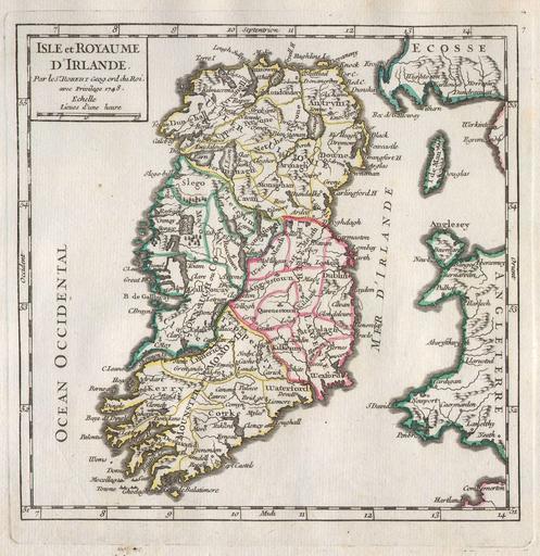
| Keywords: 1748 Vaugondy Map of Ireland - Geographicus - Ireland-vaugondy-1749.jpg A rare and beautiful 1748 Map of Ireland by the French cartographer Robert de Vaugondy Depicts the entire island with county and regional subdivisions defined Beautiful original hand color This map was originally published in the 1748 edition of Vaugondy ™s Atlas Portratif Universel et Militaire Map is dated in the title cartouche 1748 Size in 7 7 object history credit line accession number Ireland-vaugondy-1749 Geographicus-source PD-Art-100 Robert de Vaugondy Ireland 1748 maps Ireland Old maps of Ireland 1748 Maps in French Ireland | ||||