MAKE A MEME
View Large Image
| View Original: | 1747_La_Feuille_Map_of_Spain_and_Portugal_-_Geographicus_-_Spain-ratelband-1747.jpg (2500x1718) | |||
| Download: | Original | Medium | Small | Thumb |
| Courtesy of: | commons.wikimedia.org | More Like This | ||
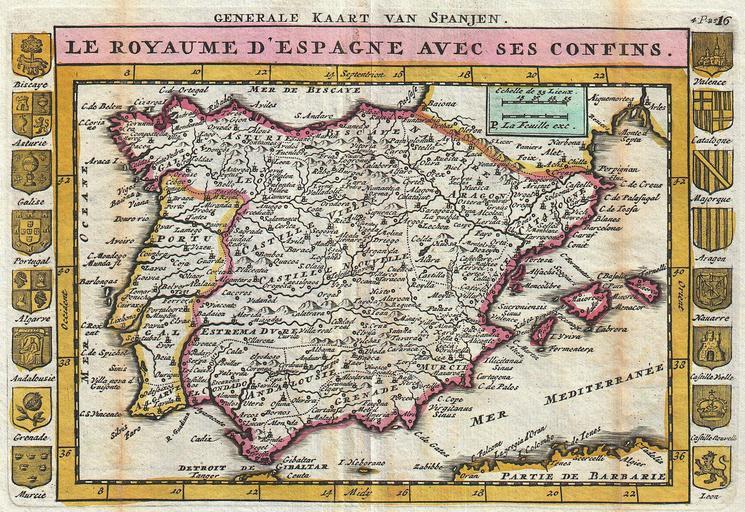
| Keywords: 1747 La Feuille Map of Spain and Portugal - Geographicus - Spain-ratelband-1747.jpg A stunning map of Spain and Portugal first drawn by Daniel de la Feuille in 1706 Depicts the entirety of Iberia including the Balearic Islands parts of France and northern Africa Surrounded on either side by the armorial crests of 16 Spanish regions Title at top of map in French and outside the margin in Dutch This is Paul de la Feuille ™s 1747 reissue of his father Daniel ™s 1706 map Prepared for issue as plate no 18 in J Ratelband ™s 1747 Geographisch-Toneel 1747 undated Size in 10 25 7 object history credit line accession number Spain-ratelband-1747 <i>Geographisch-Toneel Of uitgezochte Kaarten Tot gemak der Officieren Reisigers en Liefhebbers; Behelsende alle de generale Kaarten </i> 1747 J Ratelband issue Geographicus-source PD-old-100 Daniel de La Feuille Old maps of the Iberian Peninsula 1747 1747 maps Spain Maps in French Spain | ||||