MAKE A MEME
View Large Image
| View Original: | 1747_La_Feuille_Map_of_Languedoc,_France_-_Geographicus_-_Languedoc-lafeuille-1747.jpg (2500x1842) | |||
| Download: | Original | Medium | Small | Thumb |
| Courtesy of: | commons.wikimedia.org | More Like This | ||
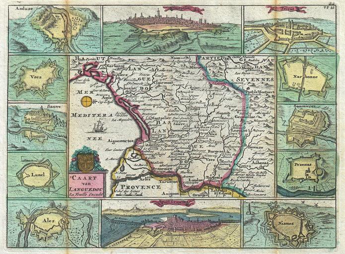
| Keywords: 1747 La Feuille Map of Languedoc, France - Geographicus - Languedoc-lafeuille-1747.jpg A stunning map of Languedoc France first drawn by Daniel de la Feuille in 1706 This province in southeastern France roughly corresponds with the modern day regions of GĂ©vaudan Velay and Vivarais Surrounded by twelve views of important villages and fortresses in this region From top right in a clockwise fashion these include Privas Narbonne Sommieres Pezenns Mismes Pont S Esprit Alez Lunel Sauve Vzez Ansuze and Montpelier This is Paul de la Feuille ™s 1747 reissue of his father Daniel ™s 1706 map Prepared for issue as plate no 27 in J Ratelband ™s 1747 Geographisch-Toneel 1747 undated Size in 9 5 7 object history credit line accession number Languedoc-lafeuille-1747 <i>Geographisch-Toneel Of uitgezochte Kaarten Tot gemak der Officieren Reisigers en Liefhebbers; Behelsende alle de generale Kaarten </i> 1747 J Ratelband issue Geographicus-source PD-old-100 Daniel de La Feuille Old maps of Languedoc 1747 maps Languedoc Maps in French France | ||||