MAKE A MEME
View Large Image
| View Original: | 1730_Homann_Map_of_Lower_Saxond_(_Berlin_Lubeck,_Hamburg,_Bremen_)_-_Geographicus_-_SaxoniaeInferioris-homann-1730.jpg (3000x2559) | |||
| Download: | Original | Medium | Small | Thumb |
| Courtesy of: | commons.wikimedia.org | More Like This | ||
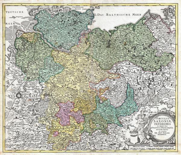
| Keywords: 1730 Homann Map of Lower Saxond ( Berlin Lubeck, Hamburg, Bremen ) - Geographicus - SaxoniaeInferioris-homann-1730.jpg A beautifully detailed c 1730 Homann Heirs map of Saxony Covers from Bremen eastward as far as Hertzogt Pomeren and southward to Thuringen Includes the cities of Hamburg Berlin Hall Gottingen Bremen and Minden The map details fortified cities villages roads bridges forests castles and topography The title cartouche in the lower right quadrant features allegorical figures and a curiously blank heraldic crest This map was drawn in Nuremberg by J B Homann and issued in Homann ™s Grosser Atlas as well as in the Homann Heirs ™ Maior Atlas Scholasticus ex Triginta Sex Generalibus et Specialibus ¦ circa 1730 undated Size in 22 5 19 object history credit line accession number SaxoniaeInferioris-homann-1730 <i>Major Atlas Scholasticus Ex Triginta sex Generalibus et Specialibus Mappis Homannianis </i> c 1750 / Also issued in Homann's <i>Grosser Atlas</i> Geographicus-source PD-old-100 Johann Baptist Homann Maps by Homannsche Erben Old maps of Lower Saxony 1730 maps Maps in German | ||||
_-_Geographicus_-_SaxoniaeInferioris-homann-1730.jpg)