MAKE A MEME
View Large Image
| View Original: | 1730_Homann_Map_of_the_English_Colonies_in_America_(United_States)_-_Geographicus_-_AmerEnglish-homann-1740.jpg (600x472) | |||
| Download: | Original | Medium | Small | Thumb |
| Courtesy of: | commons.wikimedia.org | More Like This | ||
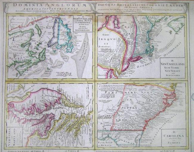
| Keywords: 1730 Homann Map of the English Colonies in America (United States) - Geographicus - AmerEnglish-homann-1740.jpg This 1730 Homann map of British Territories in North America depicts in four separate maps much of the Eastern Coast of North America This large page is divided into four separate maps Nova Scotia Newfoundland New England New York New Jersey Massachusetts Pennsylvania etc Virginia Maryland and Carolina now North Carolina South Carolina Georgia and Northern Florida 1730 Size in 22 21 object history credit line accession number AmerEnglish-homann-1740 Geographicus-source PD-old-100 Johann Baptist Homann Old maps of the United States 1730 maps | ||||
_-_Geographicus_-_AmerEnglish-homann-1740.jpg)