MAKE A MEME
View Large Image
| View Original: | 1715_De_L'Isle_Map_of_the_Eastern_Roman_Empire_under_Constantine_(Asia_Minor,_Black_Sea,_Balkans)_-_Geographicus_-_ImperiiOrientalis-delisle-1715.jpg (5000x3730) | |||
| Download: | Original | Medium | Small | Thumb |
| Courtesy of: | commons.wikimedia.org | More Like This | ||
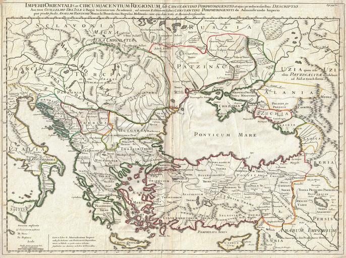
| Keywords: 1715 De L'Isle Map of the Eastern Roman Empire under Constantine (Asia Minor, Black Sea, Balkans) - Geographicus - ImperiiOrientalis-delisle-1715.jpg A very attractive c 1715 example of Guillaume De L ™Isle ™s map of the Eastern Roman Empire under Constantine c 330 AD Depicts from eastern Italy and Sicily eastwards as far as the Black Sea and modern day Armenia Includes Crete Cyprus all of the Balkans and parts of Russia Offers wonderful detail with historical notes cities and topographical elements shown in profile and historical notes where appropriate Prepared as plate 32 for De L ™lsle ™s 1718 reissue of his important Atlas de Geographie 1715 undated Size in 24 5 19 object history credit line accession number ImperiiOrientalis-delisle-1715 De L'Isle Guillaume <i>Atlas de Geographie</i> probabally the 1718 issue Geographicus-source PD-old-100 Old maps of the Roman Empire Guillaume Delisle 1715 maps Maps in Latin Old maps of the Black Sea 18th-century maps of Georgia Old maps of Armenia Old maps of Turkey Old maps of Ukraine Old maps of Tsardom of Russia Old maps of Greece Maps of Colchis Maps of the Kingdom of Iberia Maps of Alania Old maps of Bulgaria 18th-century maps of the Balkans Maps of the history of the medieval Balkans | ||||
_-_Geographicus_-_ImperiiOrientalis-delisle-1715.jpg)