MAKE A MEME
View Large Image

| View Original: | 1700_Cellarius_Map_of_Asia,_Europe_and_Africa_according_to_Strabo_-_Geographicus_-_OrbisClimata-cellarius-1700.jpg (3774x2643) | |||
| Download: | Original | Medium | Small | Thumb |
| Courtesy of: | commons.wikimedia.org | More Like This | ||
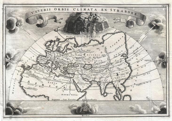
| Keywords: 1700 Cellarius Map of Asia, Europe and Africa according to Strabo - Geographicus - OrbisClimata-cellarius-1700.jpg A rare and beautifully engraved map of the old world divided into seven climatic zones according to the Ancient Greek geographer Strabo Depicts Europe Asia and northern Africa Surrounded by seven wind heads At the northern polar caps is a wonderful allegorical vignette of the mythological wind god Aiolos whose floating prison island of Aiolia constrained the storm sprits Anemoi Thuellai and Aellai Here Aiolos is shows restraining the North Wind depicted as a winged dog with a chain Cartographically this map corresponds with the late 17th century view of the world Japan Korea and Kamtschaka are absent and the Caspian Sea is drawn larger east-west than north-south circa 1706 undated Size in 12 5 8 5 object history credit line accession number OrbisClimata-cellarius-1700 <i>Notitia Orbis Antiqui sive Geographia Plenior</i> 1706 editon Geographicus-source PD-Art-100 Old maps of Asia 1700s maps of Africa Old maps of Europe 1706 maps Maps in Latin Geographica - Strabo Christoph Cellarius | ||||