MAKE A MEME
View Large Image

| View Original: | 1657_Jansson_Map_of_Germany_(Germania)_-_Geographicus_-_Germaniae-jansson-1657.jpg (3500x2811) | |||
| Download: | Original | Medium | Small | Thumb |
| Courtesy of: | commons.wikimedia.org | More Like This | ||
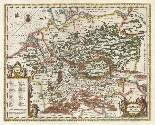
| Keywords: 1657 Jansson Map of Germany (Germania) - Geographicus - Germaniae-jansson-1657.jpg This is a remarkable example of Jan Jansson's 1657 mapping of Germany in antiquity Depicts a richly forested region covering from Gaul to Dacia and from the Baltic Sea to the Adriatic Sea Cartographically this map exhibits heavy influence from a very similar map of the same name published by A Ortelius in his 1597 Parergon Based on Greek and Roman sources including Pliny Strabo Virgil Ceasar and others Ships and monsters decorate the seas A decorative title cartouche depicting curious warlike figures in animal skins appears in the lower right quadrant A second cartouche appears in the lower left This remarkable map was published in volume six the Orbis Antiquus of Jan Jansson's Novus Atlas 1657 undated Size in 19 5 15 5 object history credit line accession number Germaniae-jansson-1657 Jansson J <i>Novus Atlas Sive Theatrum Orbis Terrarum In quo Orbis Antiquus Seu Geographia Vetus Sacra Profana exhibetur</i> Volume 6 1657 Geographicus-source PD-old-100 Maps by Jan Jansson 1657 maps Old maps of ancient Germania Poland in the 1st century Maps of Vistula Maps of San Animals on maps | ||||