MAKE A MEME
View Large Image

| View Original: | 09570jfCollege of Arts Santolan LRT Station Marcos Highwayfvf 12.jpg (4608x3456) | |||
| Download: | Original | Medium | Small | Thumb |
| Courtesy of: | commons.wikimedia.org | More Like This | ||
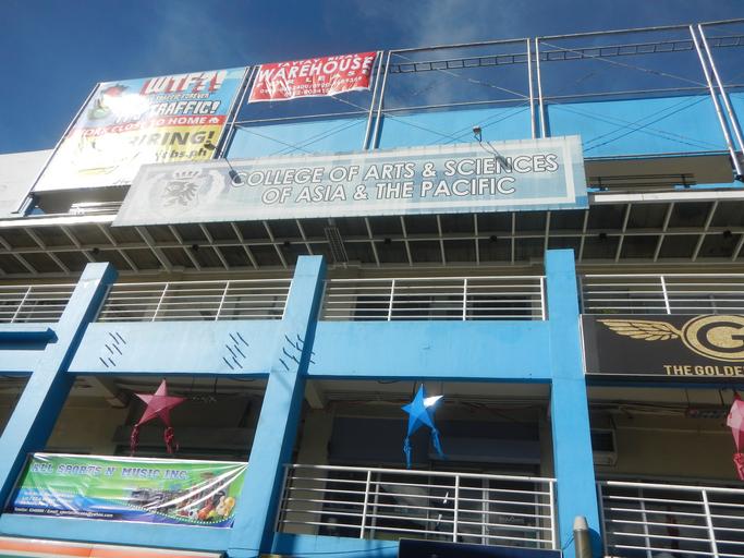
| Keywords: 09570jfCollege of Arts Santolan LRT Station Marcos Highwayfvf 12.jpg College of Arts Sciences of Asia the Pacific List of landmarks and attractions of Marikina http //wikimapia org/7179768/Tayug-Footbridge Tayug Footbridge 14°37'25 N 21°5'5 E interconnecting with the http //wikimapia org/13069506/SM-Marikina-s-Footbridge SM City Marikina Footbridge 14°37'28 N 121°5'3 E and the http //wikimapia org/13069473/Santolan-Station-Footbridge Santolan LRT Station Footbridge 14°37'19 N 121°5'11 E MRT-2 LRT-2 Santolan Station and the http //wikimapia org/62982/Marcos-Bridge Marcos Bridge 14°37'32 N 121°4'58 E along Marcos Highway Marikina City Section http //wikimapia org/street/3706/en/Marcos-Highway-Marikina-Infanta-Highway-R-6 Marcos Highway 14°36'49 N 121°20'8 E Marikina City Section Marikina River Marikina River Park under the Marikina River Park Authority 1993 system of parks trails open spaces and recreation facilities along an 11-kilometre 6 8 mi stretch of the Marikina River Carabao statues along SM City Marikina http //wikimapia org/8387437/SM-City-Marikina SM City Marikina 14°37'35 N 121°5'3 E Riverbanks Center Radial Road-6 Flyover http //wikimapia org/12779940/Riverbanks-Center Riverbanks Center 14°37'50 N 121°4'56 E Riverbanks Center and Eastern Metro-Manila Multi Modal Transport Terminal; located in Major Dizon Street and FVR Road at Barangays of Marikina Barangays http //wikimapia org/1884827/Industrial-Valley-Complex Industrial Valley Complex 14°37'30 N 121°4'41 E Orlandes IVC Green Garden Calumpang Marikina and Barangka Marikina Marikina City bounded by Legislative district of Pasig City List of barangays of Metro Manila Barangays http //wikimapia org/1702276/tl/Brgy-Santolan-Lungsod-ng-Pasig Santolan 14°36'53 N 121°5'7 E Pasig City; Santolan LRT Station Manila Light Rail Transit System Line 2 en Strong Republic Transit System SRTS Marikina “Infanta Highway Marcos Highway or MARILAQUE Highway or Manila-Rizal-Laguna-Quezon Note Judge Florentino Floro the owner to repeat Donor Florentino Floro of all these photos hereby donate gratuitously freely and unconditionally all these photos to and for Wikimedia Commons exclusively for public use of the public domain and again without any condition whatsoever 2016-11-21 14 38 01 own Judgefloro other versions 14 621944 121 086389 heading 36 18 http //wikimapia org/13069473/Santolan-Station-Footbridge Santolan LRT Station Footbridge 14°37'19 N 121°5'11 E cc-zero College of Arts Sciences of Asia the Pacific | ||||